
Ashton + Matthew

manzanita cliffs
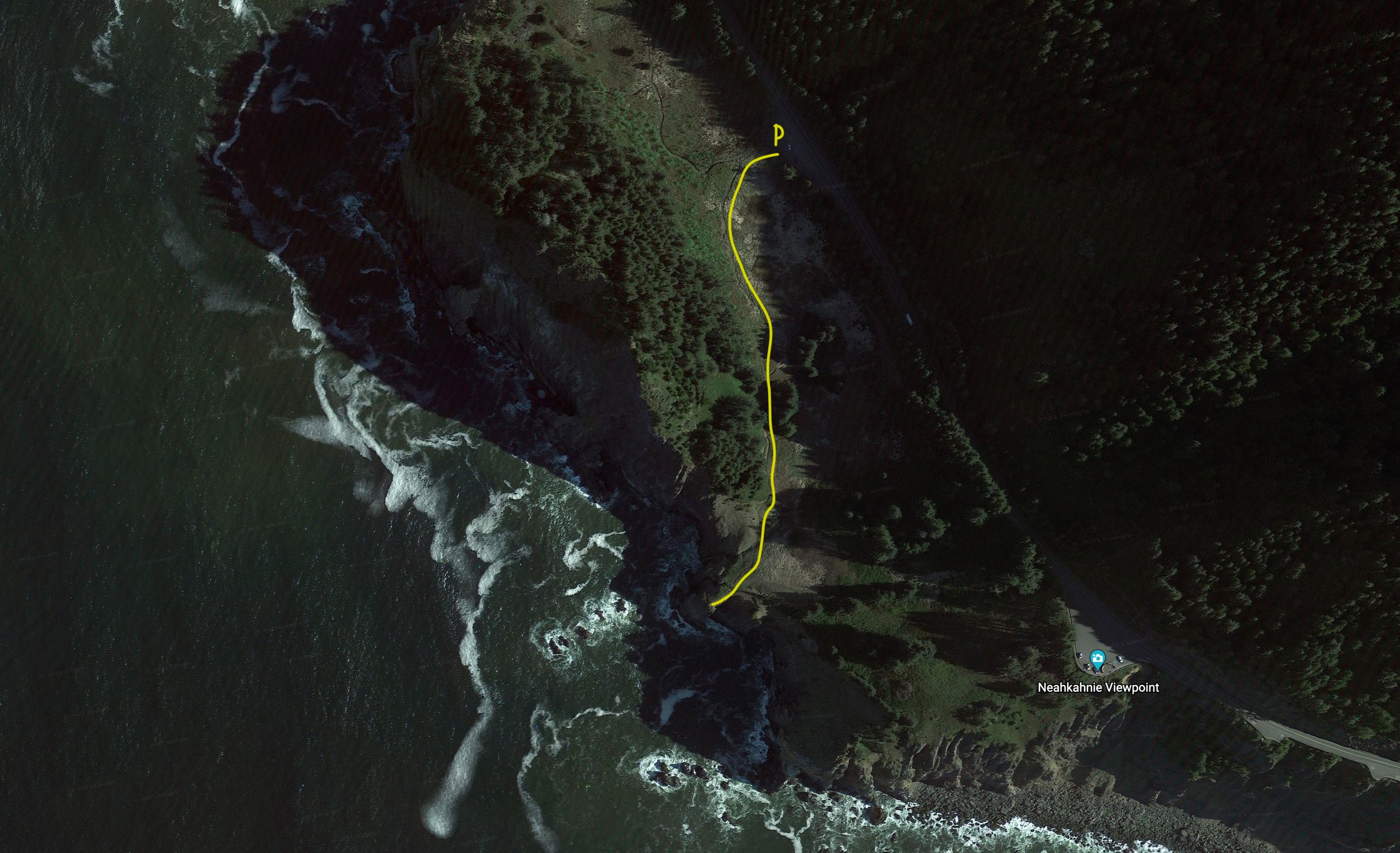
The image to the right is showing the trail that leads down to a point at the edge of the cliff. Obviously, you do not need to be that closet to the edge! There are several vantage points that are less sketchy along the cliffs. The views from the trail are stunning.
Below I have a link to a Google Earth map that will allow you to get a more realistic look at the terrain. I also to a screenshot of the trail and highlighted the path in yellow.
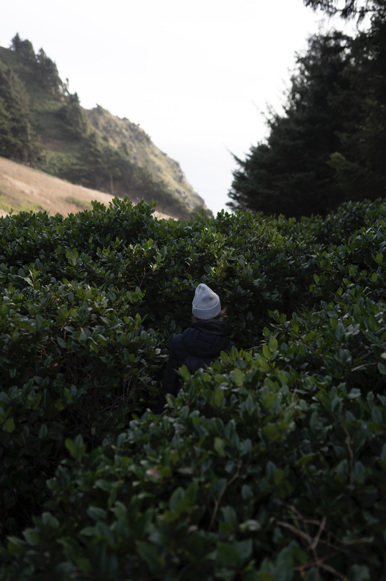
I also included a few shots from when I was there, along with a couple from a nearby beach!


Elopement Location Ideas
02/22/22
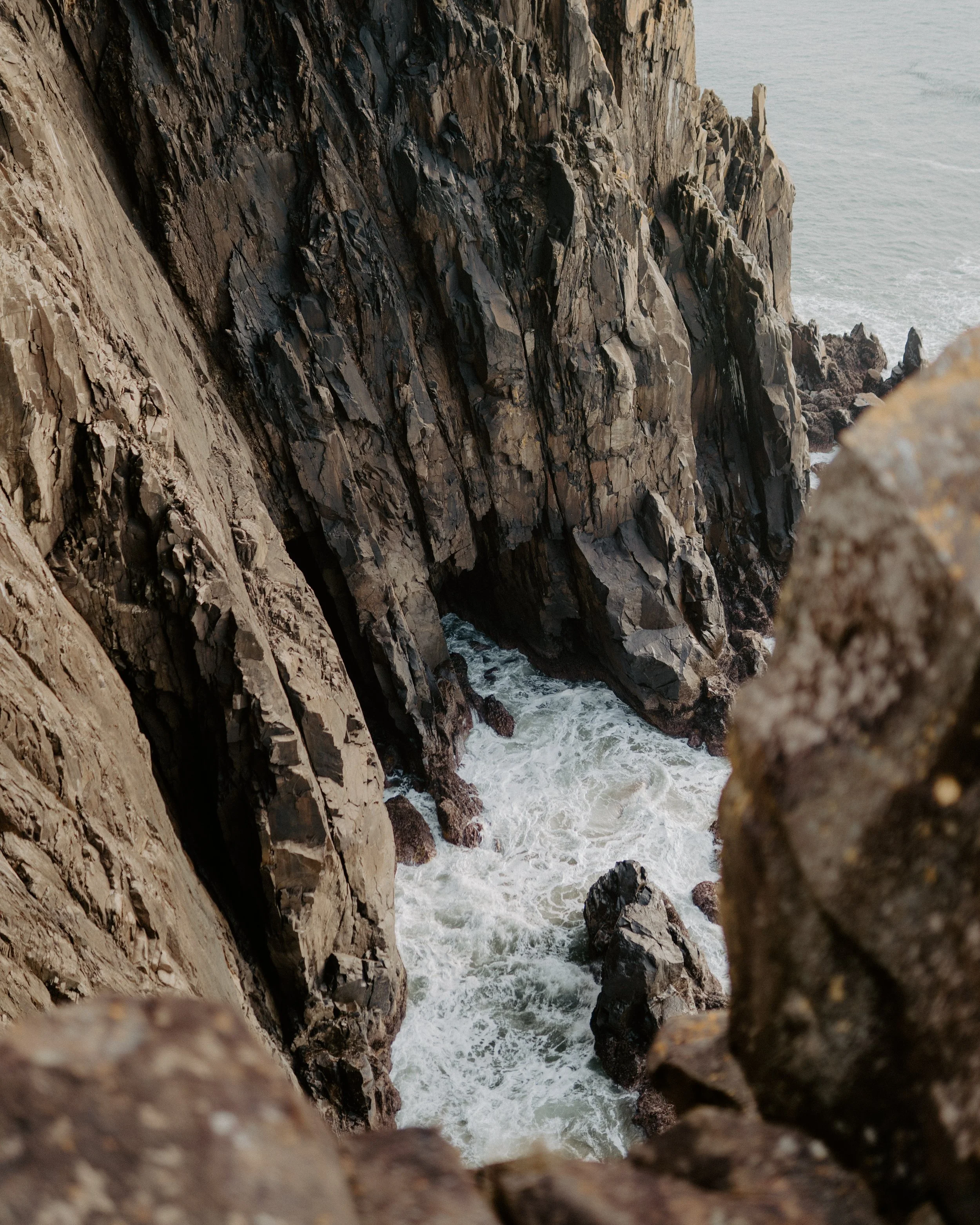
MANZANITA CLIFFS
-
Rugged cliffs with dark dramatic rock formations, grassy hillside, and insane ocean views.
-
Although the trail is less than a mile from the parking area, it is unmarked, therefore it’s very secluded.The trail is on Oregon public lands which means you do not need to obtain a permit to get married here.
-
The image above is from my last excursion to this secret spot, but, I have not shot an elopement at this location.
Here is a link to an elopement at Manzanita cliffs photographed by The Foxes.
-
Manzanita cliffs are within an hour of several other beautiful beaches that feature forests, sandy coastlines, and large rock formations coming out of the water.
Here are a few secondary options that could also be visited within the same day.
1. Arcadia Beach
2. Ecolata State Park
3. Cannon Beach
-
• Closest airport is Portland (PDX)
• Accommodations: Cannon Beach
• Weather: likely to encounter rain but no snow
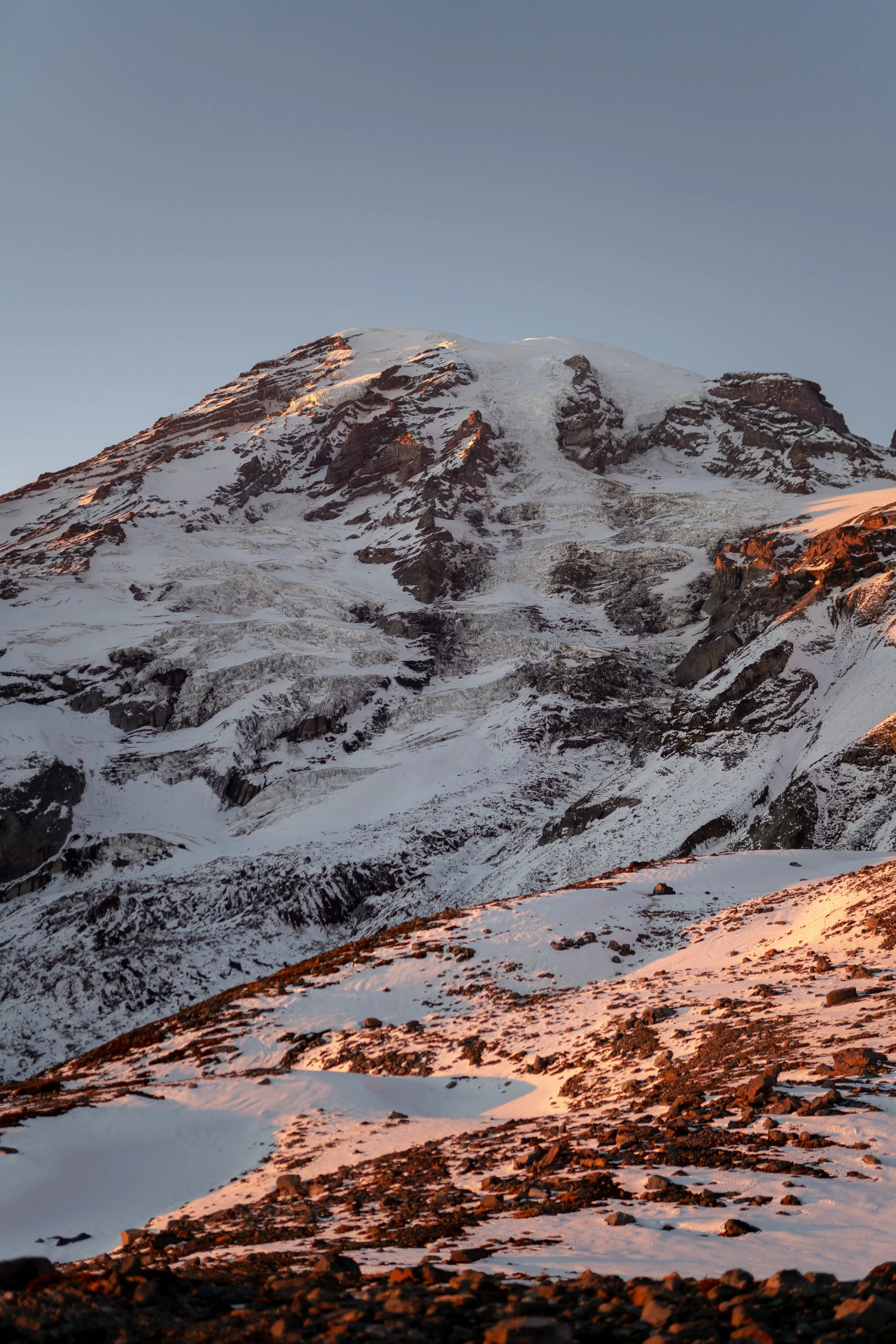
MOUNT RAINIER
-
Paradise Park on Mount Rainier offers multiple trail options that are all at high elevations.
When you drive up to the parking lot you are already at 5,400 feet. The views of the mountain on a clear day are breathtaking.
-
There are multiple trails options starting from the Paradise parking lot. There are several trails in the 1-5 mile range to choose from.
Microspikes or snowshoes will be needed for hiking at Mount Rainier in February. Both can be rented on the mountain or from REI.
It is possible that the views will be socked in by clouds if it is snowing.
-
Paradise trail systems are within Mount Rainier National Park.
You will need a park pass for your vehicle and a ceremony permit if you get married within the national park.
-
On the drive up to Paradise, Mount Rainier there are dozens of lower elevation hikes and trails along the river and in beautiful woodland areas.
Waterfalls, forests, and lakes are all options for photos and hikes below the Paradise entrance.
-
• Closest large airport is Seatac (SEA)
• Accommodations: small lodges and AirBnB’s can be found in Ashford, WA.

CAPE KIWANDA
-
Sandy beaches, large sand dunes, and dramatic rock formations.
-
From the parking lot at Cape Kiwanda, there are miles of sandy beaches to the left, a rock formation directly in front of you, and a 240-foot high sand dune to the right.
The hike to the top of the sand dune is quite the workout! Atop the sand dune, there are sweeping views of the ocean and rock formations below.
Here are some images showing the landscape of Cape Kiwanda.
-
There are several AirBnB’s and VRBO options at Cape Kiwanda / Pacific City as well as hotels and Airstream rentals.
Alternatively, Oceanside is a small coastal town that has miles of walkable beaches and other lodging options.
Tillamook Creamery is a must-see destination if you are into cheese and ice cream ;) that is 30 minutes away.
-
Thirty minutes away in Lincoln City, there is a hike called God’s Thumb.
It is a dense forest trail that opens up to a steep grassy knoll with views of the coastline.
-
• Closest international airport is (PDX) in Portland.
• Weather could be rainy and/or foggy.
• Several small towns along the coast for accommodations.
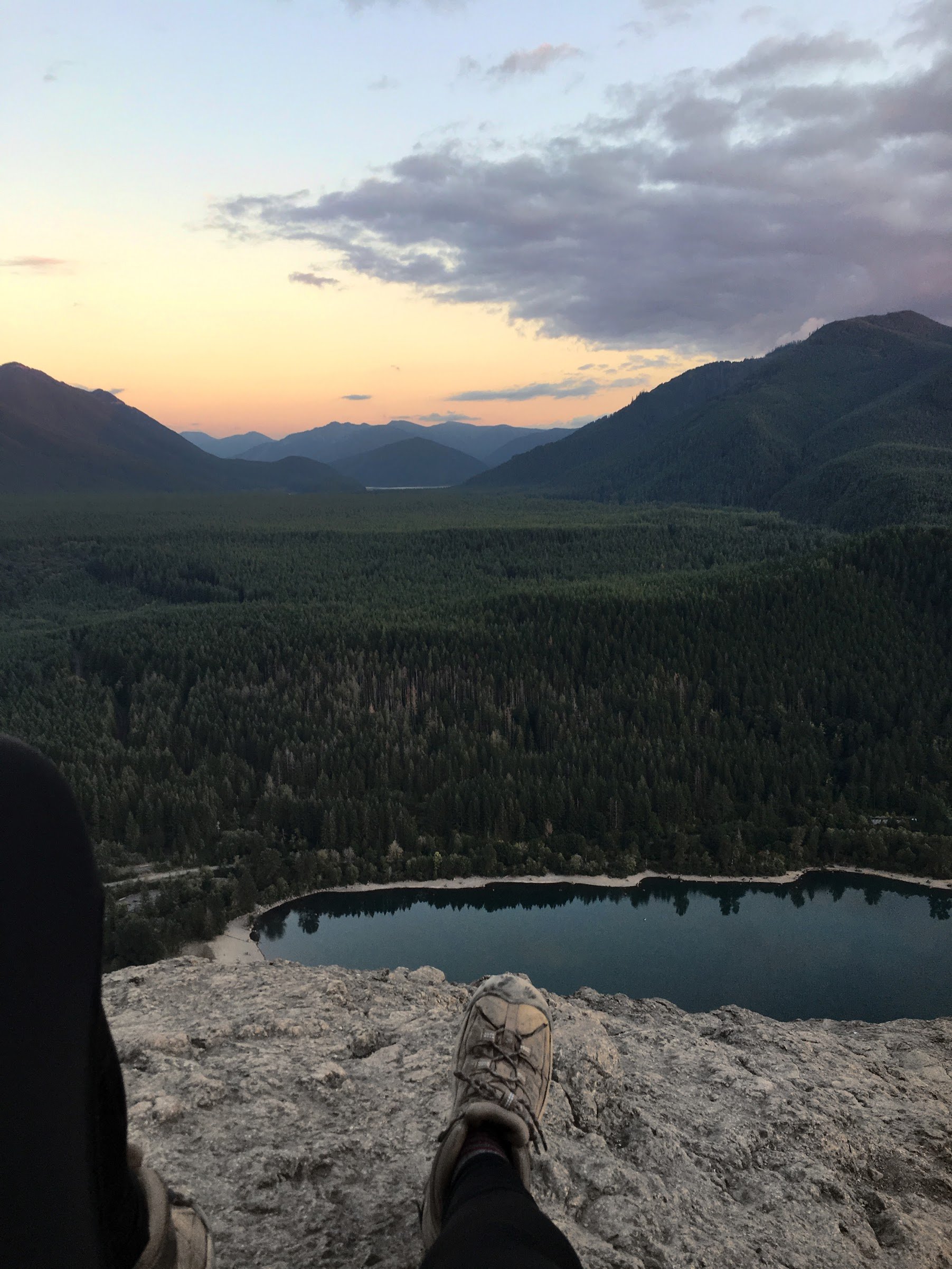
RATTLESNAKE LEDGE
-
Hike through a dense forest to a rocky summit that overlooks a large lake and surrounding mountains.
-
The hike begins at the base of the mountain near a lake.
This is a moderately difficult trail because of the distance and elevation gain (hence the epic views at the top).
The hike is a little over 5 miles round trip and has 1,500 feet of elevation gain.
Here is an elopement that was photographed at the summit.
-
It is very likely that we would encounter snow during the second half of the hiking trail.
Microspikes would be necessary for adequate footing and safety at the summit.
-
The lake at the bottom of the trail is a wonderful place for a secluded ceremony or photos on/around the water.
There are many forest roads nearby that would allow us to have other options for woodland pictures.
-
This trail is an hour and thirty minutes from downtown Seattle.
This would allow for unlimited lodging locations in the city and near the trail.
Seatac (SEA) is the closest airport.
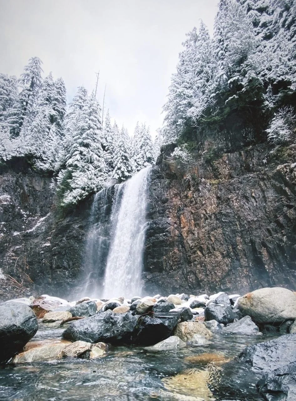
FRANKLIN FALLS
-
Meander along a forest trail, nestled next to a crystal clear river, and end up at the base of a frozen waterfall.
-
The Franklin Falls trail is a two-mile hike next to a river ending at the base of a waterfall.
There is minimal elevation gain and it is a relatively easy trail.
The waterfall will likely be partially frozen in February and there may be snow on the trail but not enough for snowshoes.
-
The trail is located on Snoqualmie Pass and is part of the National Forest system.
It is a popular trail due to its proximity to Seattle, however, weekdays will have significantly fewer people.
-
Franklin Falls is close to dozens of other hikes, including the above trail, Rattlesnake Ridge.
It is also 30 minutes from the Snoqualmie Ski Resort where you can take a lift to the top of the mountain.
-
This trail is an hour and thirty minutes from downtown Seattle.
It is close to Seatac International Airport (SEA).
There are several towns nearby that offer a multitude of options for accommodations.
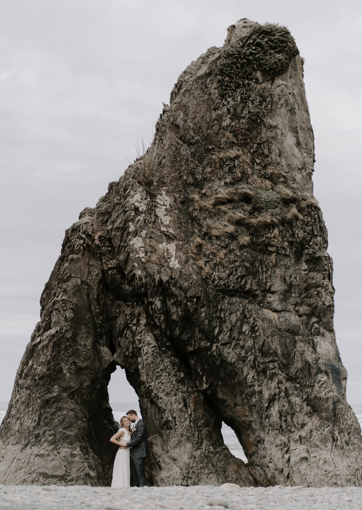
RUBY BEACH
-
A mix of pebbles and dark sandy beaches, tall dramatic rock formations jetting out of the ocean, and coastal rain forests.
-
From the parking lot, there is a short path down to the ocean.
You will walk through dozens of pieces of driftwood before landing on the rocky beach that stretches the coastline.
This is a very popular beach, however, in February I believe it will be much less crowded.
-
Ruby Beach is inside the Olympic National Park and will require a park entrance pass for your vehicle and a ceremony permit.
There will not be snow at the beach, however, we may encounter rain and fog.
The drive out to Ruby Beach is stunning and goes through an actual rainforest.
-
There are a few lesser-known beaches within 15 minutes of Ruby Beach that are less crowded.
Each of these additional beaches offers a slightly different landscape making them incredibly unique. I have pictures from each of these beaches if you are interested.
• Beach 1
• Beach 2
• Tree of Life (Kalaloch Beach)
There are also lush forest trails within an hour of Ruby Beach. These trails have moss-covered trees, dense undergrowth with ferns, and several waterfalls.
-
The closest large town to Ruby Beach with plenty of accommodations is in Port Angeles.
There is also a lodge and campground 10 minutes from Ruby Beach if there is still availability.
The town of Forks, WA has a few Airbnb’s as well.
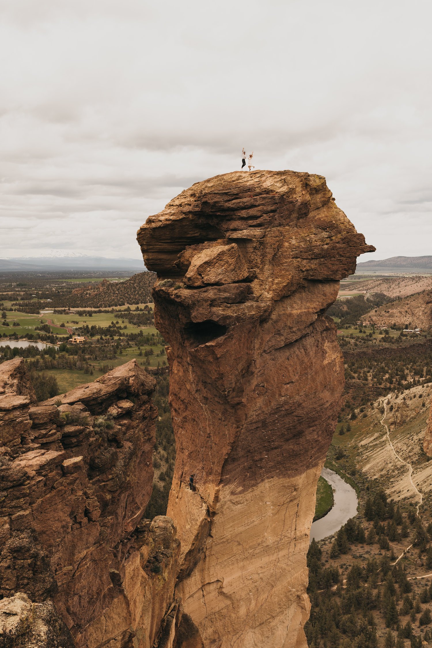
SMITH ROCK
-
Large cliffs, rock formations, and a winding river.
-
The trails wander through the large rock formations along the river.
There are several trails to choose from in the 1-5 mile range.
• Rim Rock
-
Smith Rock State Park is primary a rock climbing site and has more climbers than hikers.
Central Oregon is drier than the coast, however, there may be some snow on the ground in February.
This is an Oregon State Park and will require a parking pass and a ceremony permit.
Here is a climbing elopement at Smith Rock State Park.
-
Steelhead Falls Trail is a 25-minute drive from Smith Rock State Park.
It is a two-mile round trip trail with a minimal elevation gain that ends at a waterfall.
-
The town of Bend, OR has a welcoming outdoor community and lots of options for accommodations and dining.
The closest international airport is Portland (PDX), however, there is also a small airport in Redmond, OR that is much closer.
Map of Location Ideas
Hey guys!
I just wanted to remind you, these locations are suggestions, not your only options!
If something stands out, let’s dive a little deeper as to why that location caught your eye.
In the meantime, I made a map showing each of these locations so you can get a sense of direction:
Package
Pricing
$3800 for full day of coverage within WA state
$600 per additional day
$350 deposit, with the remaining amount paid in full 30 days prior to your elopement date. The remaining payment amounts can be structured in any way that works best for you.
Planning:
unlimited communication
location scouting
permit and booking assistance
secluded ceremony locations
gear and packing checklists
personalized elopement timeline
Photography:
images delivered via online gallery
teaser photos within three days
entire wedding edited in six weeks
unlimited digital downloads
printing rights to all of your images